
The paucity of accurate geospatial data, including population settlement data presents a major obstacle to adequate decision making and development across Nigeria. A vast number of the most vulnerable human settlements in Africa remain unmapped. In the event of a public health emergency, knowing where people live, the best ways to reach them, and the locations of basic necessities such as hospitals, emergency services, schools etc. are of paramount importance.
Francis Aigbokhaevho is a HIV/AIDS Counselling Psychologist at the Oyo State Agency for Control of AIDS, who works with a team in the field and in health centres/hospitals, to locate and provide HIV testing and counselling services to indigenes of Oyo State. Francis and his team regularly carry out household surveys on these hard to reach populations and are often unable to locate unmapped settlements especially in the rural areas. In addition to this, the paper-based system the Agency operates, makes it difficult to keep track of data collected during these surveys.
“Sometimes we encounter input errors when transferring the data collected on paper into the system.”
In response to this obvious need for accurate data for planning and development, eHealth Africa, working in a global partnership with Bill and Melinda Gates Foundation (BMGF), Department For International Development (DFID), University of Columbia, United Nations Population Fund (UNFPA) and Flowminder, launched the Nigeria Geo-Referenced Infrastructure and Demographic Data for Development (GRID3) Project in June 2017, to build on the work already completed in the eleven northern States through the Global Polio Eradication Initiative (GPEI) in Nigeria (2014-2015), by mapping the remaining 25 states and FCT of Nigeria. Oyo State provided 207 data collectors from relevant ministries, departments and agencies including the State Bureau of Statistics, State Primary Health Care Development Board and the State Ministry of Health. eHealth Africa trained them to carry out the mapping exercise using technology driven data collection tools.
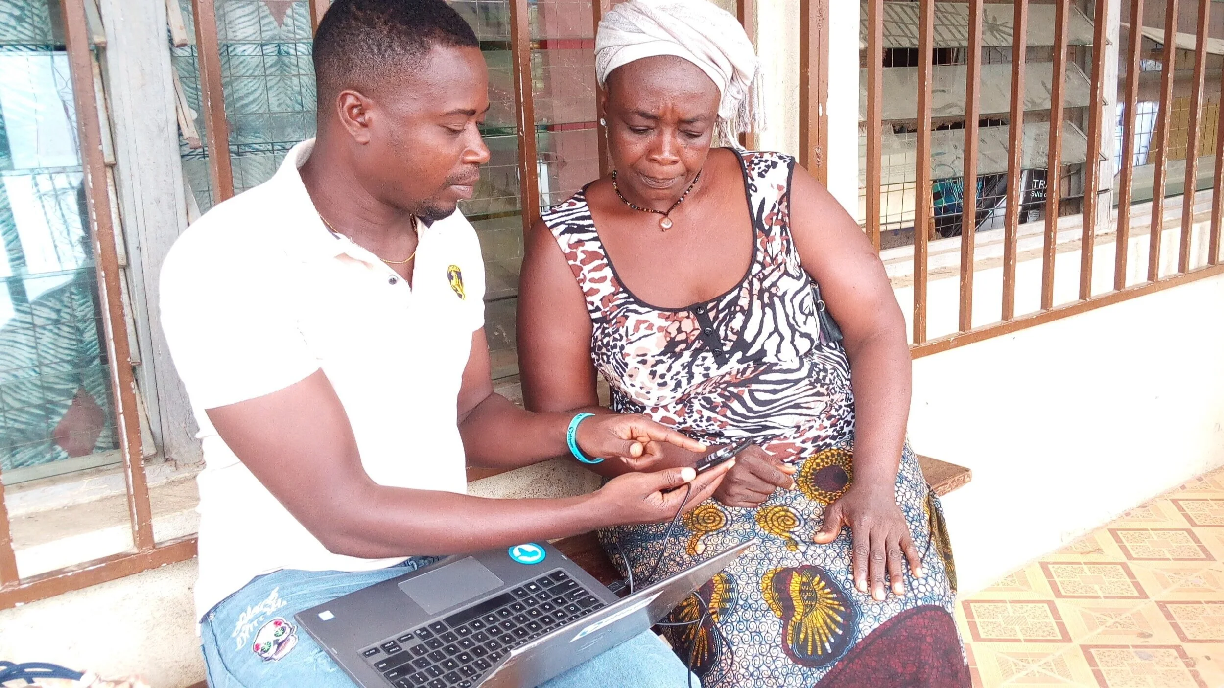
Francis was one of the 207 data collectors nominated by the state to undergo the training process. Being used to paper-based data collection methods, he had never used such technologically advanced tools and was at first skeptical and overwhelmed.
“I was not familiar with these applications- ODK collect and Geo-ODK applications. I hadn’t used these tools before”
However, he was happy to learn a new skill and gain knowledge about a better, faster and more accurate way of data collection.
Recounting his experience during the data collection process, Francis described GRID3 as an intersectoral project. He explained that it gave him the opportunity to work with his fellow government workers on the field to improve the data in his state. Francis was particularly thankful for the efficiency of the tools which enabled him as well as other data collectors to completely map all the 33 local government areas of Oyo state in only 20 days.
“The tools used to collect data on the GRID3 Project are more reliable and consistent, compared to what we are previously used to.”
Francis was also thankful that locating settlements during his surveys would be easier with the data collected during the Oyo State GRID3 data collection exercise.
Beyond Francis’ work, the GRID3 data will improve planning and decision making for public health interventions in Oyo state leading to development and a better quality of life for all.
Download this story

Read more